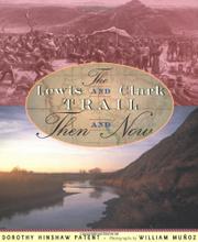
THE LEWIS AND CLARK TRAIL
Then and Now
by Dorothy Hinshaw Patent & photographed by William Muñoz
When Lewis and Clark were about to undertake their famous journey in 1803, North America was divided into five sections: the US, the British-controlled northern and western areas to the Rocky Mountains, the Louisiana Territory, the southwest, controlled by the Spanish, and the unclaimed Oregon country. Lewis and Clark’s mission was to find a water route across the continent, map the west, and collect specimens of plants and animals; Patent’s mission is to “compare the wilderness they explored with the America of today.” Lewis and Clark’s mission got mixed results. The Rocky Mountains dashed their hopes of a water route across the continent, but they did return with natural riches and tales of adventure. Their tales inspired a new generation of exploration and settlement, ultimately a disaster for the Indians, who suffered diseases and the takeover of their lands. Patent’s mission, too, gets mixed results. It’s a fascinating premise to retrace the trail and see what has changed. Farms, towns, cities, and dams have changed much of the landscape, but the wilder parts of the Rocky Mountains are much the same, and monuments along the way preserve memories of the grand adventure. But the work reads more like a scrapbook—brief chapters on various facets of the trek, accompanied by photographs, maps, and excerpts from journals. Readers who want the drama of the journey would do better to read a novel such as Bruchac’s Sacajawea (2000) and use this volume for background information. This will be a useful research tool, though the bibliography is skimpy, suggesting only a small number of books and Web sites, including the author’s own. Still, this is a must for library collections on the subject. (author’s note, resources) (Nonfiction. 9+)